


SPIRIT - T 1 Voting District, Price County, Wisconsin
About
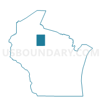
Outline

Summary
| Unique Area Identifier | 696352 |
| Name | SPIRIT - T 1 Voting District |
| County | Price County |
| State | Wisconsin |
| Area (square miles) | 41.54 |
| Land Area (square miles) | 41.05 |
| Water Area (square miles) | 0.49 |
| % of Land Area | 98.82 |
| % of Water Area | 1.18 |
| Latitude of the Internal Point | 45.42452280 |
| Longtitude of the Internal Point | -90.09632220 |
Maps


Graphs
Select a template below for downloading or customizing gragh for SPIRIT - T 1 Voting District, Price County, Wisconsin


Neighbors
Neighoring Voting District (by Name) Neighboring Voting District on the Map
- HILL - T 1 Voting District, Price County, WI
- KNOX - T 1 Voting District, Price County, WI
- KNOX - T 2 Voting District, Price County, WI
- PRENTICE - T 1 Voting District, Price County, WI
- RIB LAKE - T 1 Voting District, Taylor County, WI
- RIB LAKE - T 2 Voting District, Taylor County, WI
- SOMO - T 1 Voting District, Lincoln County, WI
- TOMAHAWK - T 1 Voting District, Lincoln County, WI
Top 10 Neighboring County Subdivision (by Population) Neighboring County Subdivision on the Map
- Rib Lake town, Taylor County, WI (852)
- Prentice town, Price County, WI (475)
- Tomahawk town, Lincoln County, WI (416)
- Knox town, Price County, WI (341)
- Hill town, Price County, WI (333)
- Spirit town, Price County, WI (277)
- Somo town, Lincoln County, WI (114)
Top 10 Neighboring Unified School District (by Population) Neighboring Unified School District on the Map
- Tomahawk School District, WI (10,010)
- Prentice School District, WI (2,966)
- Rib Lake School District, WI (2,673)
Top 10 Neighboring State Legislative District Lower Chamber (by Population) Neighboring State Legislative District Lower Chamber on the Map
Top 10 Neighboring State Legislative District Upper Chamber (by Population) Neighboring State Legislative District Upper Chamber on the Map
Top 10 Neighboring 111th Congressional District (by Population) Neighboring 111th Congressional District on the Map
Top 10 Neighboring Census Tract (by Population) Neighboring Census Tract on the Map
- Census Tract 9601, Taylor County, WI (4,290)
- Census Tract 9706, Price County, WI (2,268)
- Census Tract 9604, Lincoln County, WI (1,929)
- Census Tract 9603, Lincoln County, WI (1,775)
Top 10 Neighboring 5-Digit ZIP Code Tabulation Area (by Population) Neighboring 5-Digit ZIP Code Tabulation Area on the Map
- 54470, WI (2,068)
- 54556, WI (1,298)
- 54459, WI (1,148)
- 54490, WI (893)
- 54513, WI (478)
- 54564, WI (387)